Perkiomen Mapping & Flood Mitigation Study
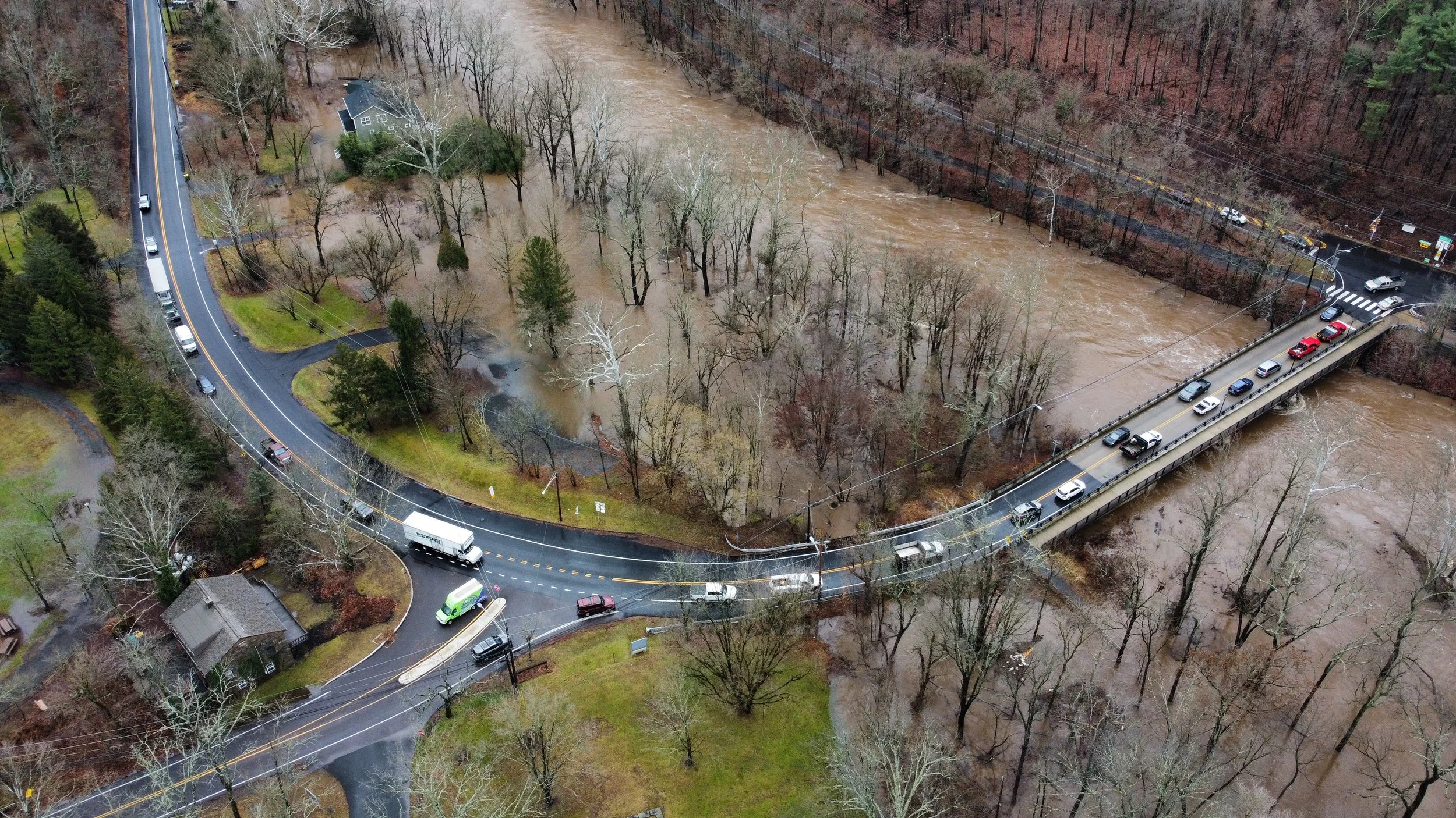
Flooding in our communities can be devastating. The Perkiomen Mapping & Flood Mitigation Study is the first phase of a long-term effort to help communities make more informed decisions regarding how and where to best implement stormwater management systems and projects.
DOWNLOAD THE FULL REPORT
DOWNLOAD THE FULL REPORT
Don’t have time to read the full report? Check out the Chapter Summary HERE!
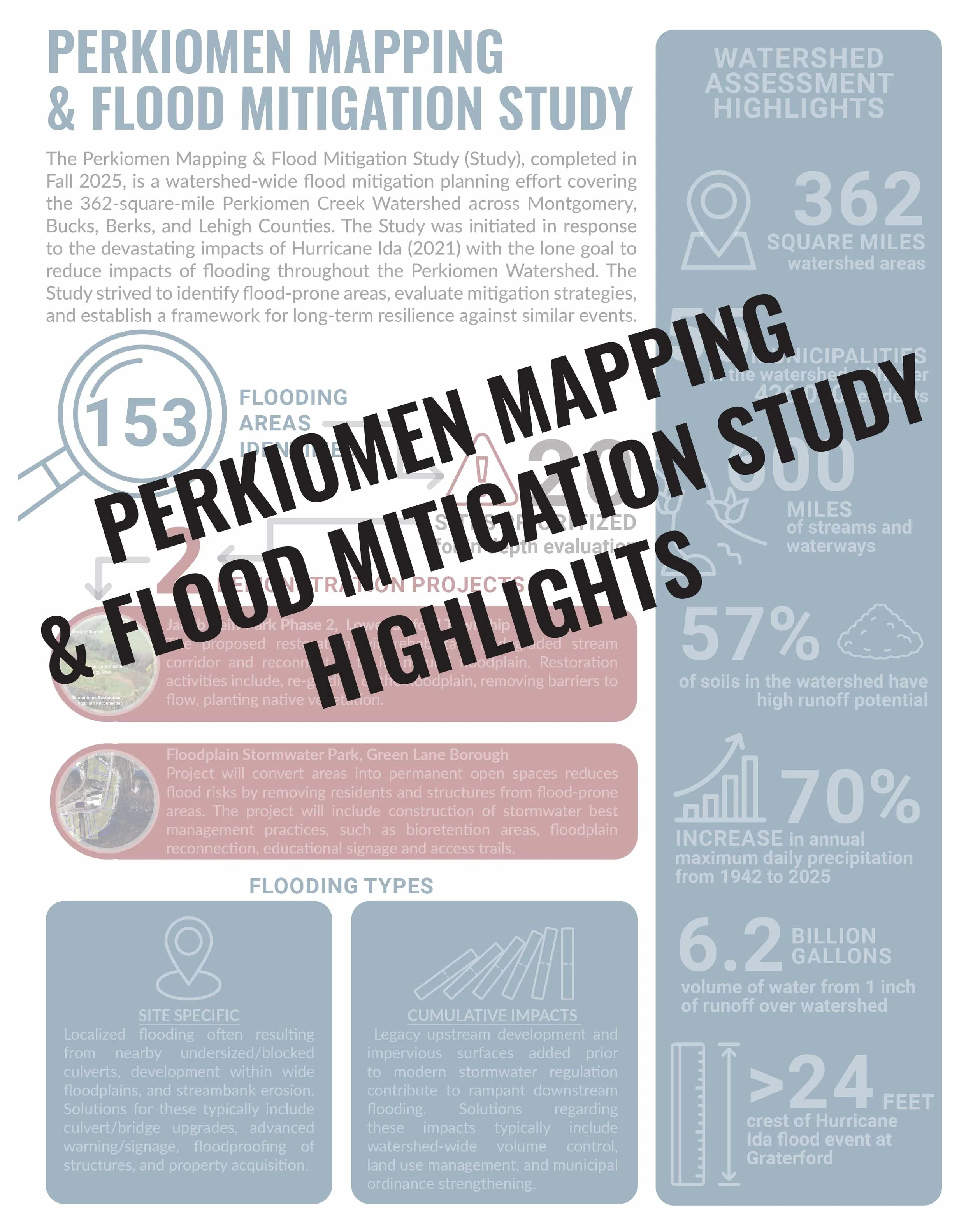
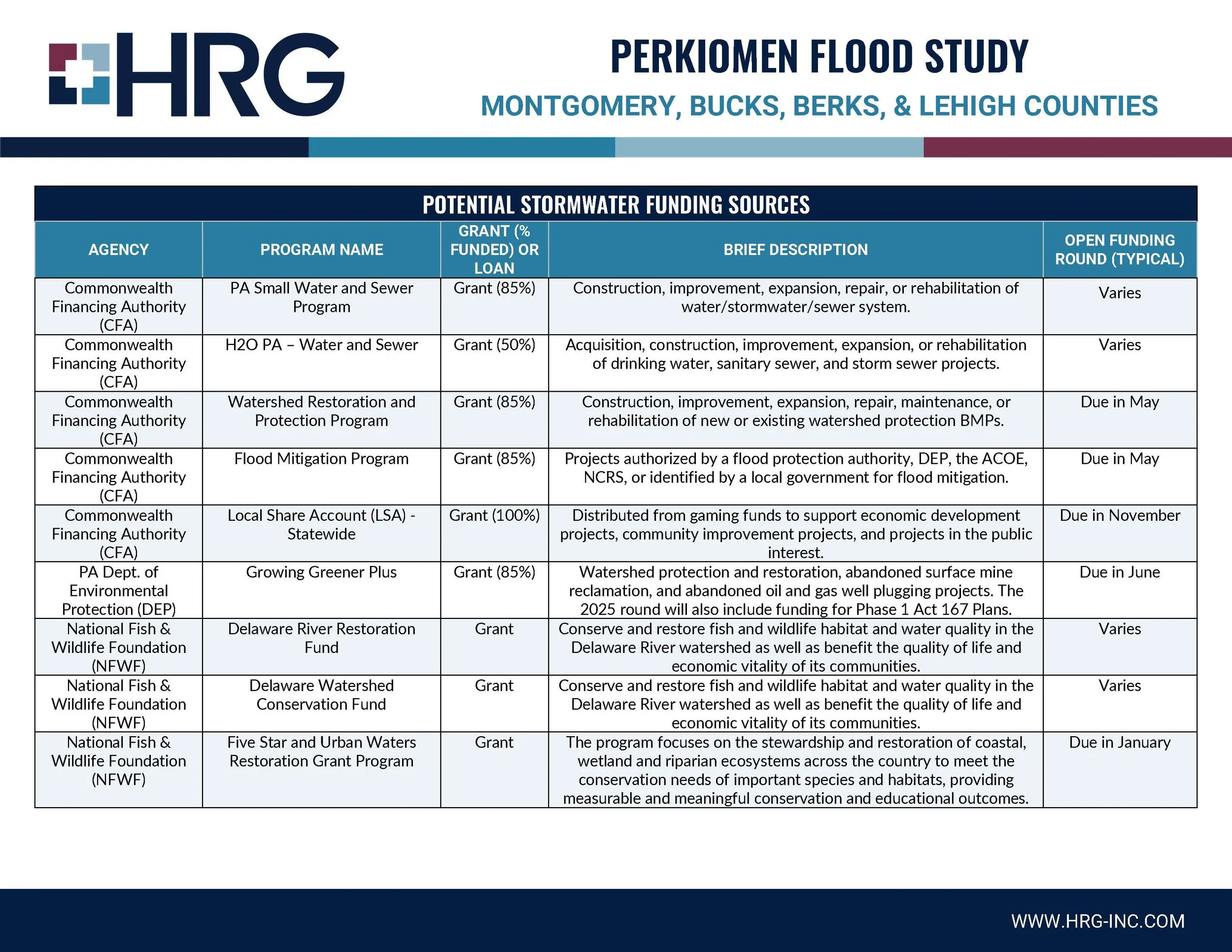
Findings
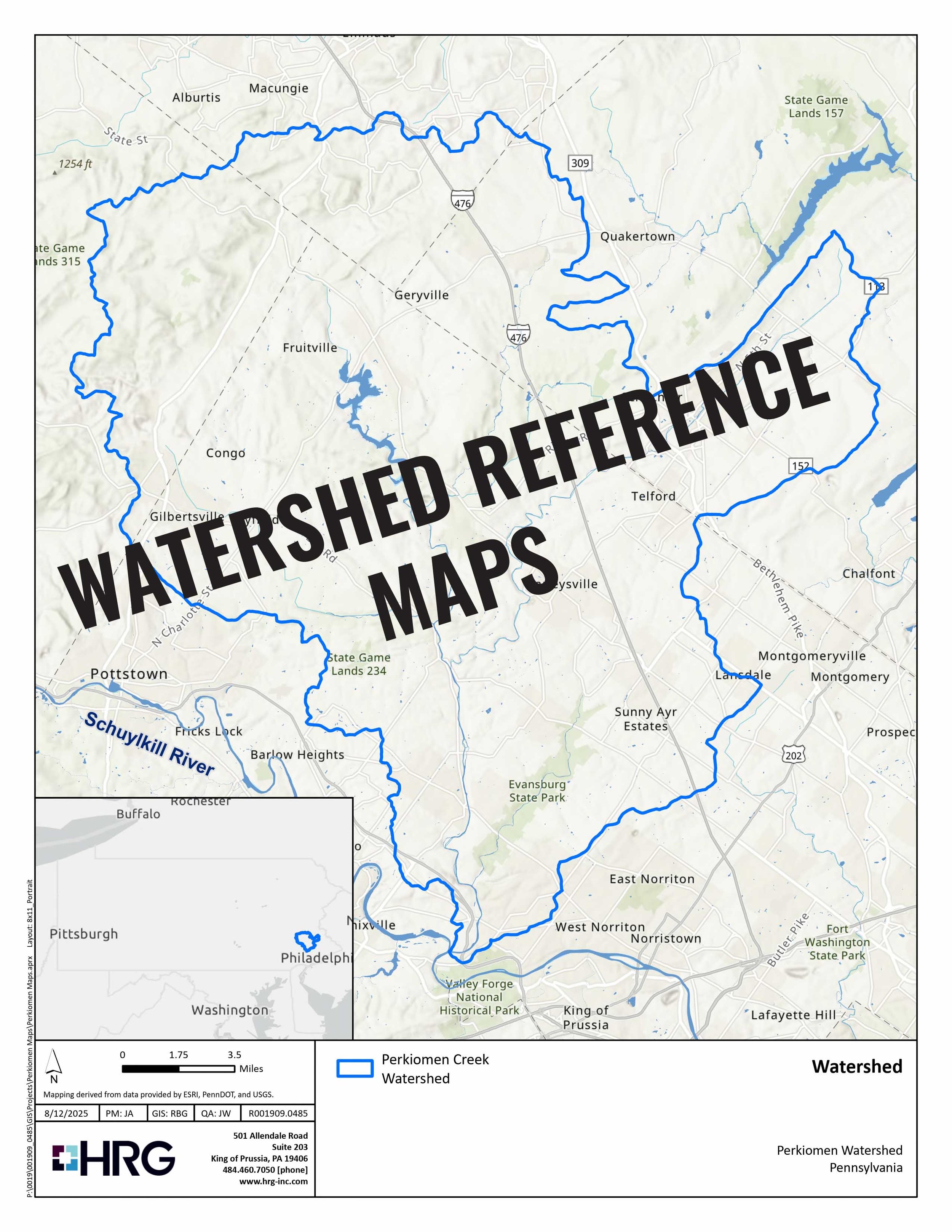
The Perkiomen Mapping & Flood Mitigation Study (Study), completed in Fall 2025, is a watershed-wide flood mitigation planning effort covering the 362-square-mile Perkiomen Creek Watershed across Montgomery, Bucks, Berks, and Lehigh Counties. The Study was initiated in response to the devastating impacts of Hurricane Ida (2021) with the lone goal to reduce impacts of flooding throughout the Perkiomen Watershed. The Study strived to identify flood-prone areas, evaluate mitigation strategies, and establish a framework for long-term resilience against similar events.
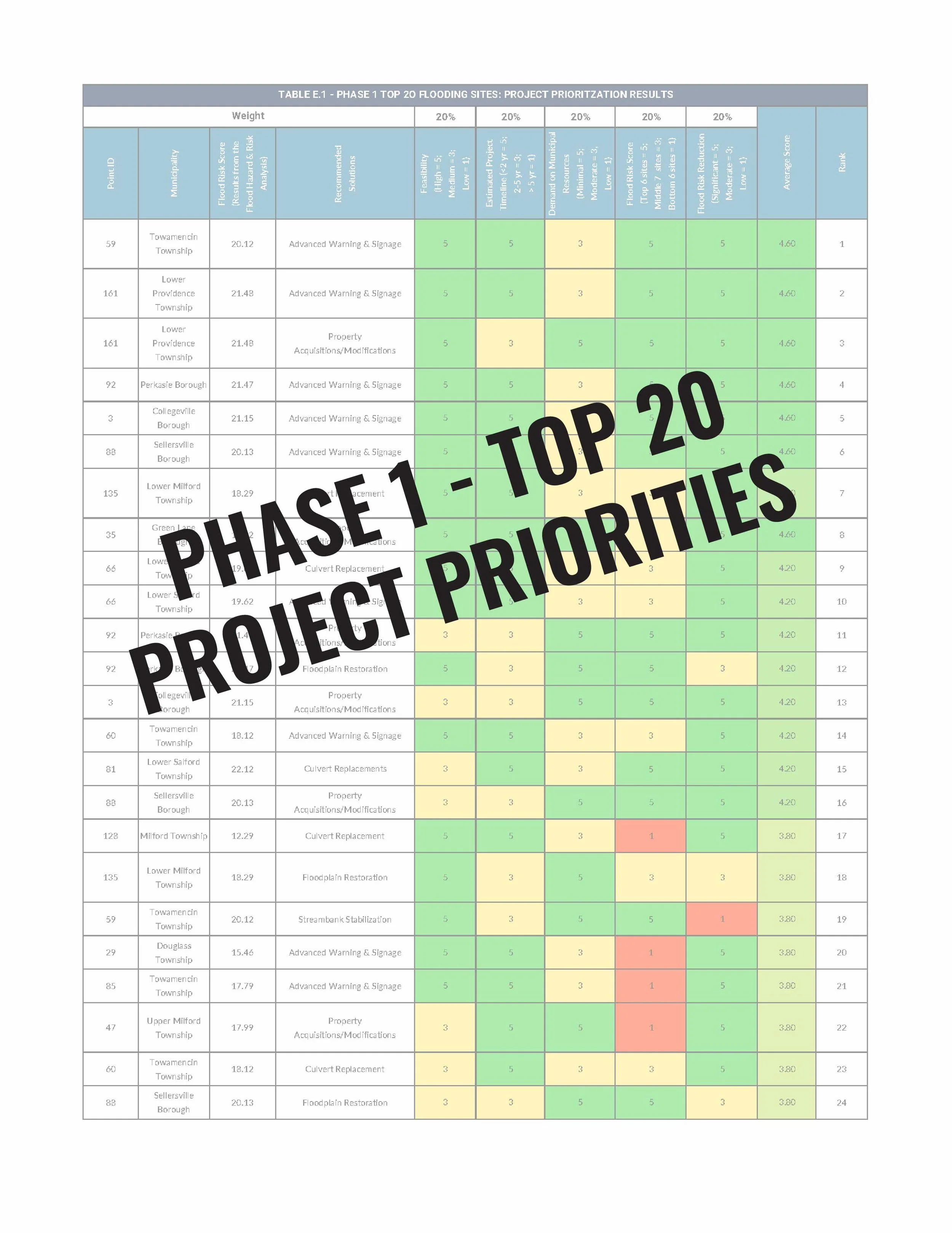
Recommendations
Short-Term

Medium-Term

Long-Term

Demonstration Projects

Blog Updates


Thanks to our Perkiomen Mapping and
Flood Study Team!


